Remote Visual & Dimensional / Reality Capture
Remote Visual & Dimensional / Reality Capture services from MISTRAS provide detailed visual and measurement data for assets and environments that are difficult to access or assess through conventional inspection methods. These services support evaluation, documentation, and planning activities by capturing accurate representations of asset condition and geometry without physical contact.
Schedule expert consultation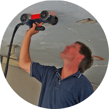
Clearer visibility and measurement for informed decisions
When direct access or manual measurement is limited, visual and dimensional capture technologies provide a practical alternative. Remote Visual and Reality Capture services deliver accurate visual records and dimensional information that help teams better understand asset condition, geometry, and spatial relationships. This clarity supports more informed inspection planning, engineering evaluation, and project coordination.
Remote visual and dimensional tools allow assets and environments to be assessed without the need for extensive physical access. This approach supports evaluation in confined spaces, congested areas, or locations where traditional inspection access may be limited.
Dimensional capture provides precise measurements and spatial information that support engineering review, design validation, and modification planning. Accurate dimensional data helps reduce uncertainty and supports better decision-making across inspection and project workflows.
High-quality visual capture creates a permanent record of asset condition at a specific point in time. This documentation supports comparison over time, collaboration across teams, and clearer communication during inspection, maintenance, or project activities.
The right solution for every asset challenge
Explore our Remote Visual & Dimensional / Reality Capture services below and contact MISTRAS to apply visual and measurement technologies tailored to your assets and operational needs.
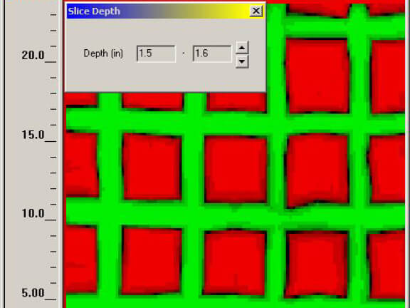
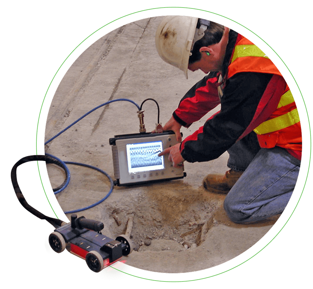
Ground Penetrating Radar (GPR)
Ground Penetrating Radar is used to image subsurface features and conditions without excavation or surface disruption. GPR supports identification of buried structures, utilities, and anomalies to assist with planning, assessment, and risk reduction activities.
Learn more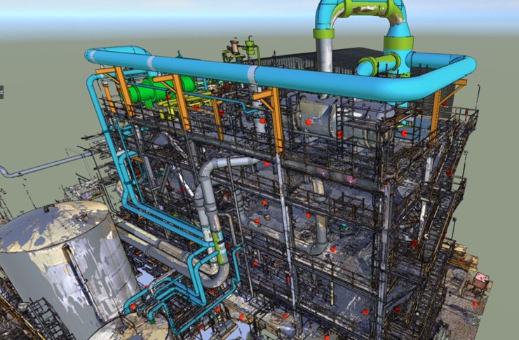
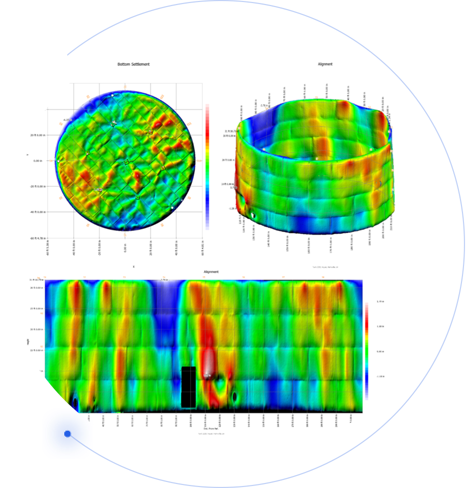
Laser Scanning
Laser Scanning captures detailed three-dimensional representations of assets and environments. This service supports accurate dimensional measurement, spatial analysis, and visualization for inspection, engineering, and project planning applications.
Find your solution
Whatever the challenge, we have the depth of expertise and breadth of solutions to deliver certainty.
Solve your most complex challenges
Partner with MISTRAS Field Services to inspect, access, and repair your critical assets. Contact our experts to define the integrated solution that maximizes your safety and operational uptime.
Schedule expert consultation